
“Best one day walk in New Zealand”
– Lonely Planet
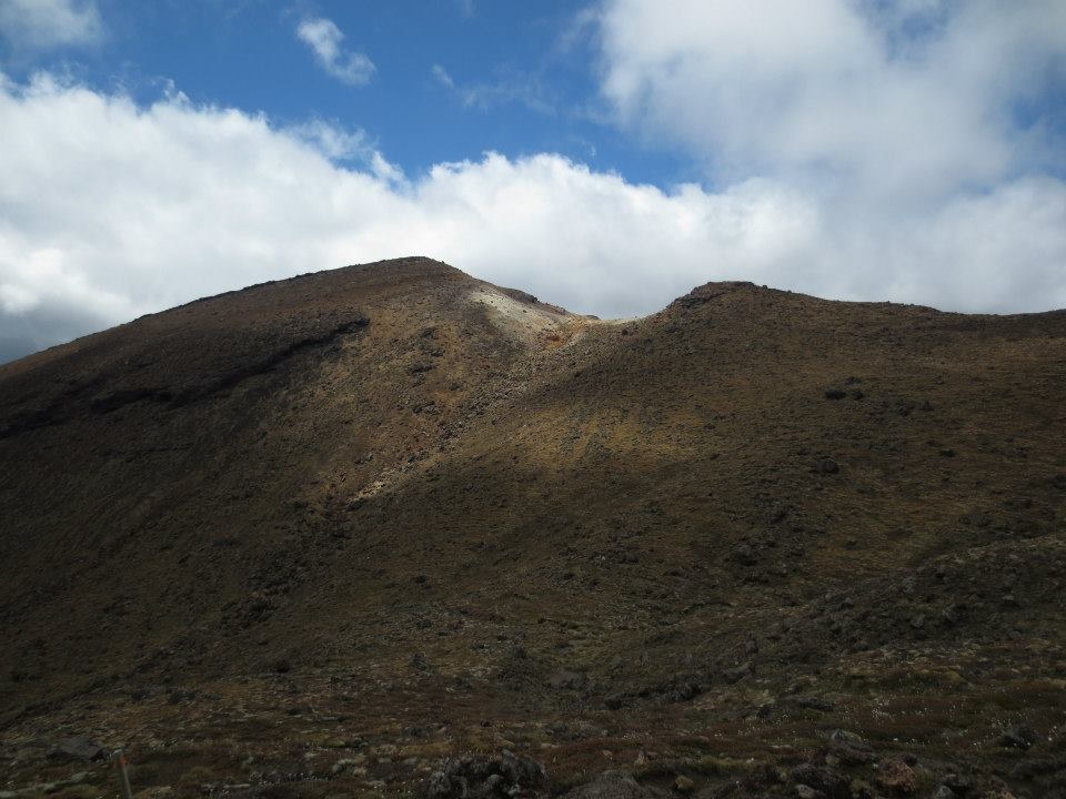
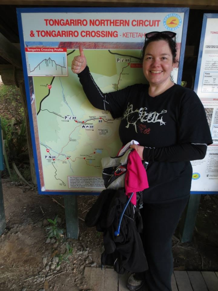
I’m already struggling with this post because it hasn’t hit me with full force yet. I actually did the Tongariro Alpine Crossing. 19,4 km and I can’t even remember the climb rate on the track (but the steepest climb was actually the most fun and brought the most reward). Oh, wait, found it in the brochure. Highest point is Red Crater, 1900m, woop!
I should explain, I’m not one of those Norwegians who was born with skis on her legs and a yearning to walk for hours cabin to cabin. I enjoy the cities of the world more than the isolation of the mountainside, ever since I was a child I always preferred the buzzing life in more populated areas. I like the noise, the crowd, the mania.
But every once in a while, I really enjoy nature too. How can you not, it’s by far the most beautiful piece of artwork we have. This time around (in New Zealand), I had decided to drive through the central plateau and Taupo. I had two friends recommending the Tongariro to me, saying it was a highlight for them and I decided I would put it on my list. I kicked myself for not putting the soundtrack to Lord of the Rings on my iPod, though… that would’ve been some epic geekiness… But the final song on the Oblivion soundtrack did the trick.
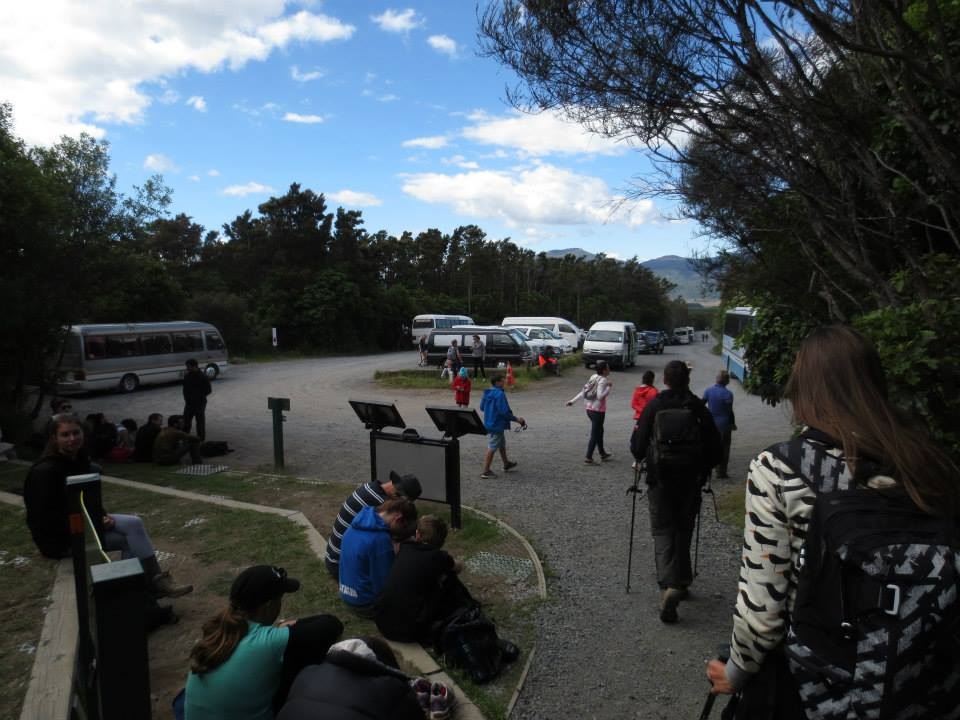
The day started with a 6AM wakeup-call, a light breakfast and getting on a little shuttle from ROAM (“all roads lead to ROAM”, oh yes…) The driver made sure everyone had sturdy shoes (“No jandals, anyone?”), plenty of water, told us the weather forecast and made us write our names down so that if you get lost and miss the last pickup, they can come look for you (“we don’t leave anyone behind, folks”). I wasn’t worried about that, to be honest. I got the earliest shuttle, to give me the most amount of time to do the track. I expected it would take me longer than the 8 hours estimated, but shorter than the 10 hour maximum (for the shuttle service).

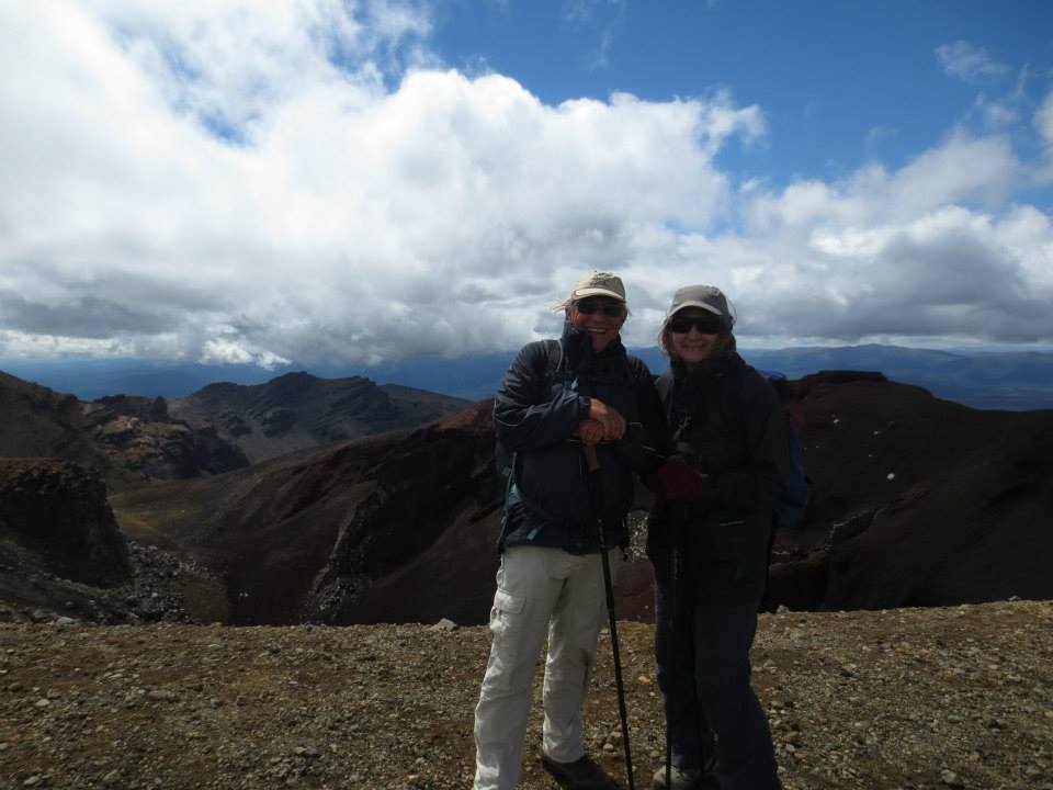
At the start of the trek. It’s all about the attiude 😉
The track started normally enough, look towards the mountain and follow the 100 other people walking the track. We were so lucky with the weather! It was sunny and nice, but not scorching, some clouds here and there. We made it to the first post, Soda Springs, where people used the last bathroom facilities for a while and the huge sign said: “Consider turning back!” – I thought “A plague on your negativiteh!!!” and continued on.
I feel compelled to mention here the Asian dude (I think he was Japanese) who showed up in jeans, a jeans jacket and something that looked a lot like flip flops, with a white grocery bag with a small bottle of water and some other stuff in it. He was not well prepare #UnderstatementBlaaargh
He was kindly taken aside and shot in the head.
Just kidding. But he WAS taken aside and shown the back of the van where the people responsible for knowing who went into the park (and picking us back up) kept all the extra gear. He was fitted with a jacket and a backpack and some other stuff (proper shoes, I would imagine) before he was allowed to attempt the trek.
I guess even us Norwegians not obsessed with hiking know a thing or two about walking around in nature compared to people from… well… a lot of other places…
The climb up to South Crater seemed really steep and I thought it was going to take me forever, but I was encouraged to see that others where also doing it one staircase at a time. The track is pretty much unavoidable (and you shouldn’t avoid it either, it’s there to protect the plants), and it’s well made. We even had free entertainment now and then from the helicopter choppering materials in to fix parts of the track. Anyway, acoording to my friend Ryan it used to be called The Devil’s Staircase, because it used to go pretty much straight up the hillside, now it meanders more and he just calls it The Devil’s Ramp…
Great view. And this was just the beginning.
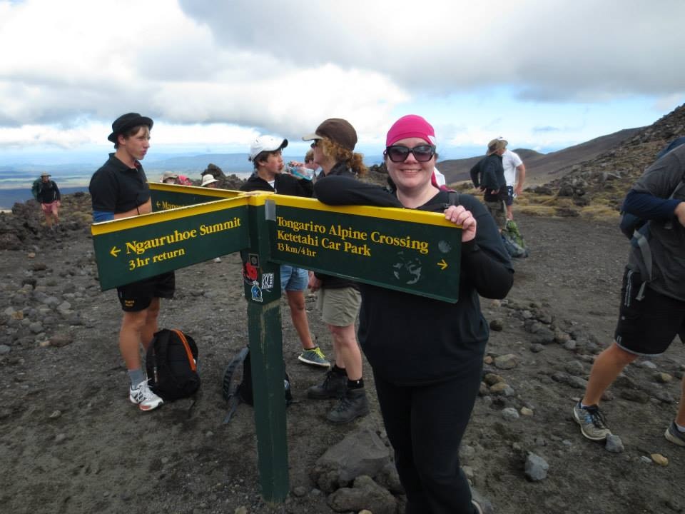
The two Dutch girls behind me took a break and said: “Holy fucking shit, something in Dutch” (I asked, she said it was freakin steep). After traversing the staircase the group divided into those going for Mt. Ngauruhoe and those continuing the crossing. I opted out of doing anything but the crossing, (I mean, let’s not get ridiculous here…)
The Dutch girls
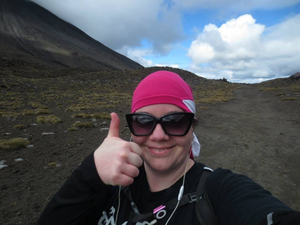
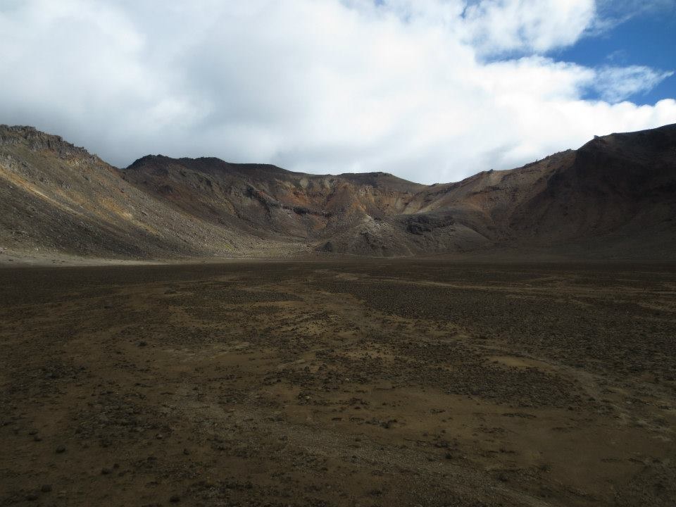
One of my favourite parts followed – The South Crater. I popped my earplugs in and started up the song from Oblivion (M83 feat. Susanne Sundfør) and walked my way across. It’s flat, but oh so beautiful there. It was like being in a moon landscape, Mt. Ngauruhoe on my right, smaller mountains on my left and straight ahead, the ridge we were going for. I loved it, absolutely loved it.
First uphill stage done
On my way again, Oblivion soundtrack on play
More great views
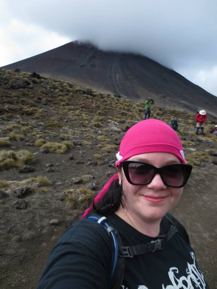
Mt. Ngauruhoe in the back, my new friends, Lauren & Alex were climbing this while I was doing the track.

Like being on the moon
The climb up the ridge was strenuous, but not exhausting. I took plenty of breaks along the way, even stopping to help an American dude who mentioned in passing that his shoe was chafing. I had brought Compeed (blister plasters) and offered him some. Insta-friends, woop woop! (Maybe not “insta” as he initially was like “Uuuh… uhm… no thanks… I’m… Uh, I’m fine…” And I was like “Dude. You’re in pain. Just take the plaster-thingy, I have so many of them.” And the he was like “Yeah, ok… Well… Thank you.” and wandered off to sit down and apply my magical chafe-sorcery to his heel. He actually came up to me later on the hike, tapped my shoulder and said “Hey, those band aids worked really well, I can’t even feel it anymore. Thanks a lot!”
So… Hourafter-friends. Maybe).
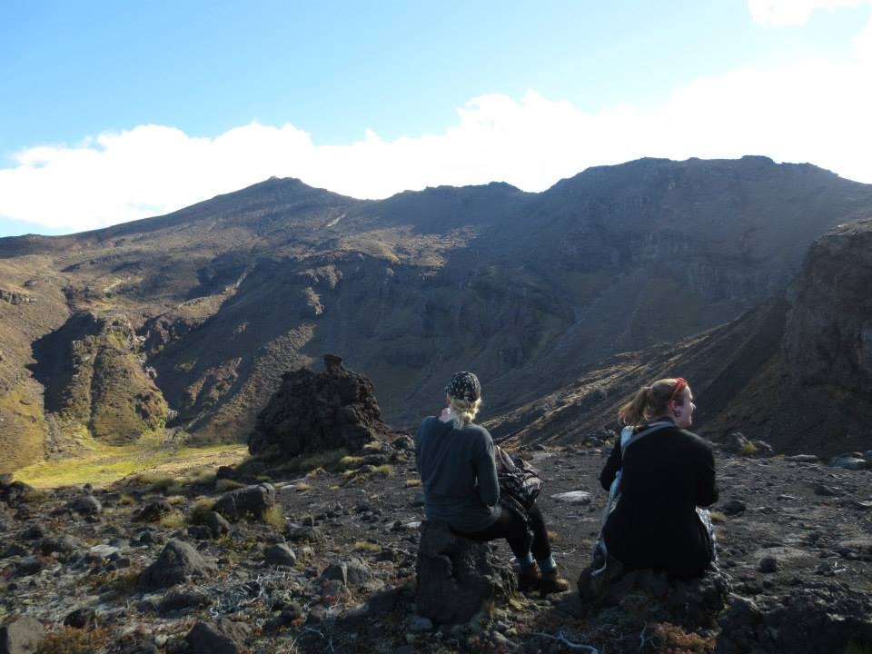
Anywho: Made it to the ridge, enjoyed the view, took way to many photos – of course, a lot of the photos were just an excuse to take a break, haha!
Artwork copyright: M. Nature
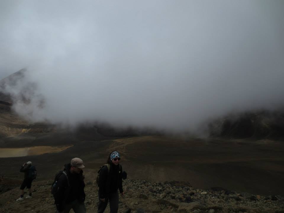
Up to the Red Crater is a bit of a climb, but I found it quite fun, it breaks the monotony and every time you stop there’s a fantastic view almost 360 degrees. We got a bit of a show from Mother Nature too when she rushed a huge cloud our way and almost enveloped us in fog for a few minutes – amazing!
Here it comes…
The Red Crater though… getting up there was almost too amazing for words. With the wind rushing around us, the skies clearing up and a teeny tiny hill to walk up before the crater revealed itself before us. Red and black sand all around, and the ever-famous “vulva”, it looked alien and magnificent! I stood around chatting for a bit with Andrea (Kiwi) and Terry (UK) a married couple I met on the way up, we shared some fruit and various travel stories and took pictures of each other to “prove to our friends we were there”. Unfortunately I lost them on the way down… too bad, I wanted to e-mail them some pictures that turned out great.

The Red Crater

Terry getting a Kodak moment in…
Terry & Andrea
Me imitating my friend Verena, who has a similar picture. Found out it was in the wrong place, but what the hell…
After the Red Crater there’s just a little climb left before you reach the highest peak of the trek, not a problem at all at that point, to be honest. High on achievement everyone bravely plodded onwards. Except the two Asian guys who lay down right there on the track. A few concerned hikers nudged them and asked if they were okay, they were… taking a break? Praying? I don’t know, but they weren’t in any trouble so they were left alone.
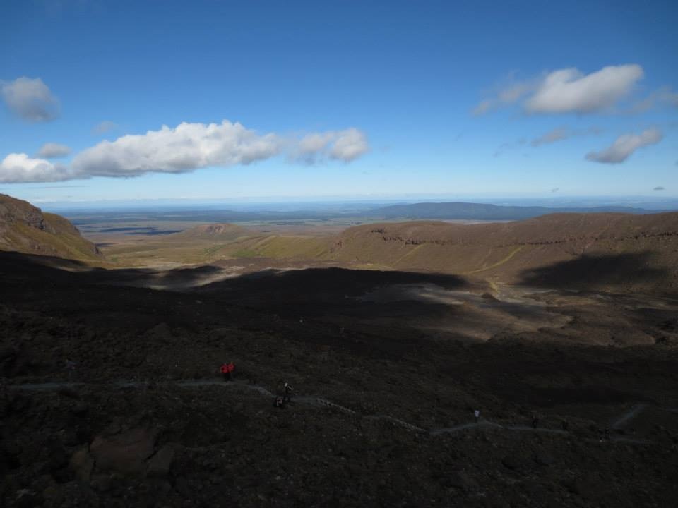
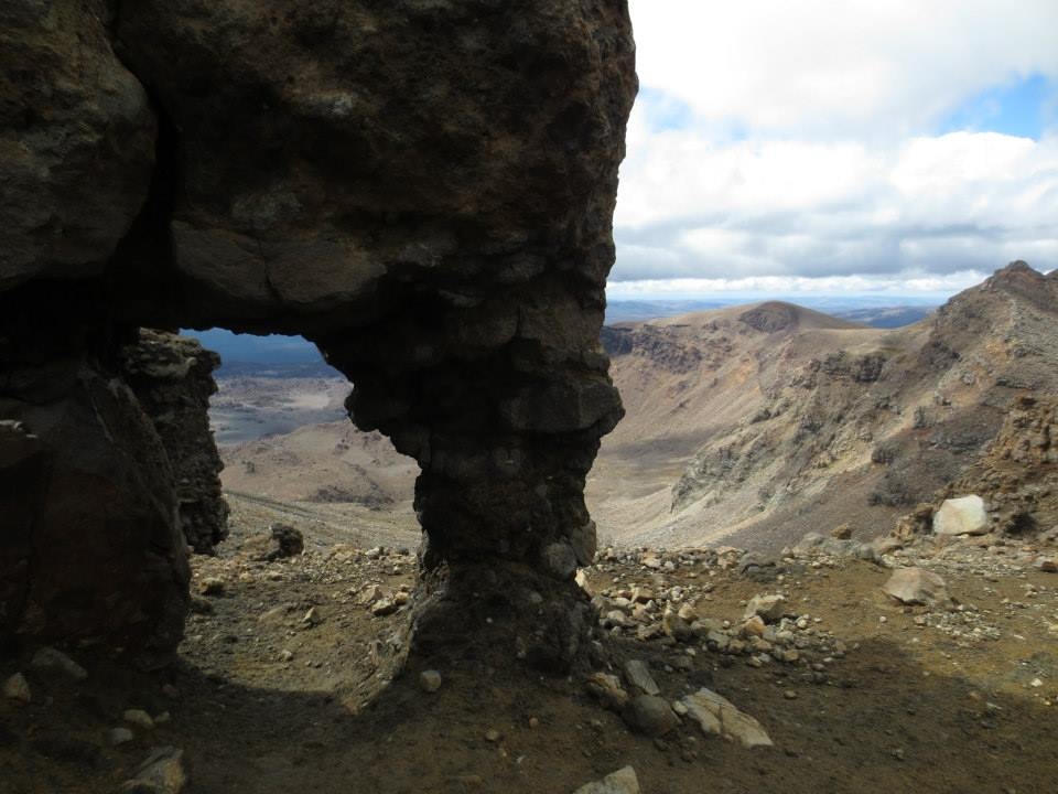
The last bit of climbing rewarded us with a fantastic view of the Emerald Lakes and the Blue Lake. More pictures and standing around enjoying the views and the winds. The landscape really is breathtaking, words in a blog can’t describe them and I am sorry that I have such a poor camera, but hopefully the pictures will convey some of the awesome beauty.
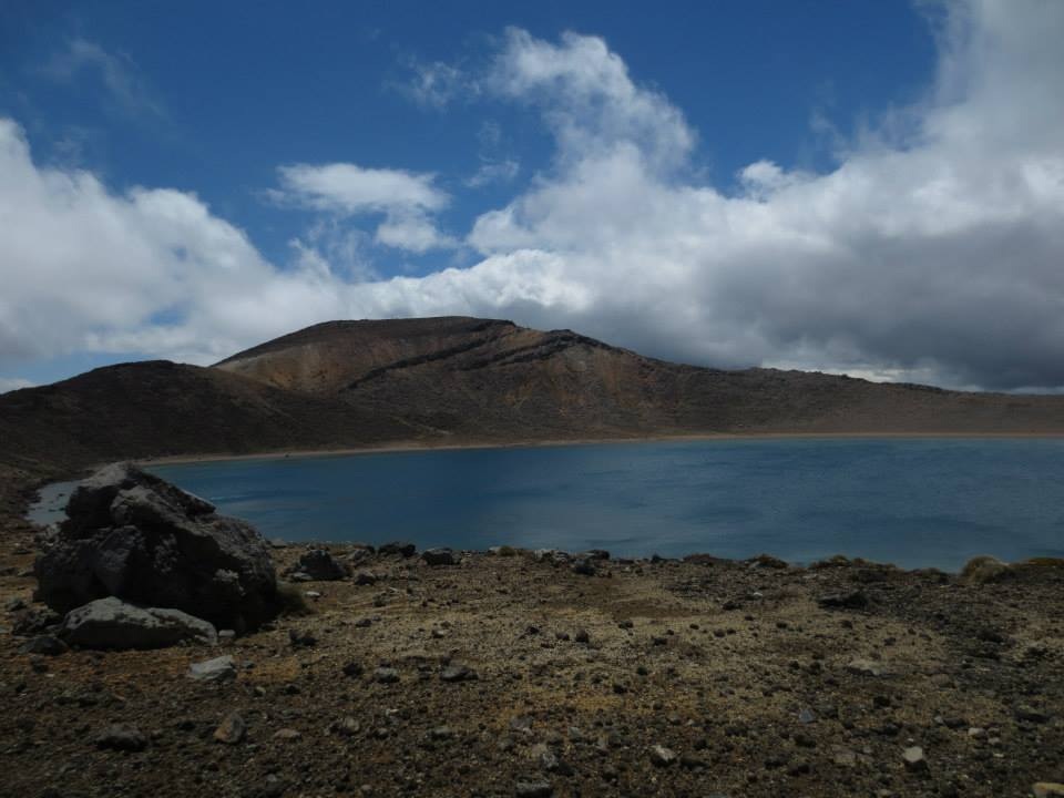
The Blue Lake
Going down…

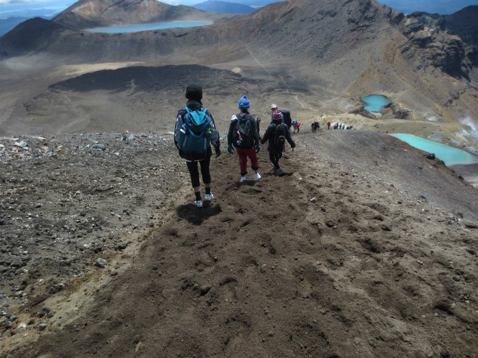
Emerald Lakes

Going that’a way
Now for the bad part. Remember how I said that I expected to spend less time than the maximum 10 hours on the trek? Well, I was right, thank God, so no one had to come look for me or pick me up later. However… And this really is the bad part. Like I said, I never thought I wouldn’t be able to do it, the only thing I didn’t know was how long it would take me in the shape I’m in. I found the climb(s), going upwards, tiring and was out of breath quite a few times, but no more than many who took the trip alongside me. Going up was good. Coming down was hell.
The trek from the Blue Lake and down to the car park where you get picked up is done in two stages. Stage one takes you via some very Norwegian looking mountain paths (and as long as they were straight I was fine) downwards, meandering (ENDLESSLY MEANDERING!) towards the Ketetahi Hut (where there’s a toilet, woop!). After that it’s more meandering for 1,5 hours down to the car park.

Awesome beauty

Stay away from sacred areas… and also, places of volcanic eruption-ish
This erupted in 2012 – woop! That would’ve put a dampner on hikes, wouldn’t it…

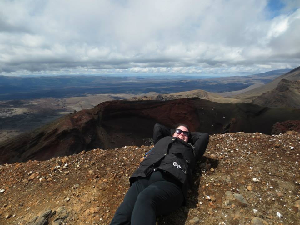
Still beautiful, still smiling…
The going downhill part turned out to be my own private hell. I am convinced I spent an hour more than I would have had to, had my knee not given up. My left knee is not happy with walking downhill for such an amount of time and decided enough was enough, so halfway down after Ketetahi I was reduced to walking sideways down the steps one step at a time. I hurt badly. Not enough to give up, mind you, but, and I really mean this: By the time there as 1,5 hours left of my trek I was absolutely DONE with this whole hiking business. God damnit.
Such a shame too, because even though it was painful, the last part through the forest was really, really beautiful and I know I could’ve enjoyed it so much more…
Anyway, I’m not gonna go on about the hell part, it wouldn’t have felt like much of an achievement if it’d been super easy 😉
Was it worth it in the end? Absolutely.
Will I do it again? Well, never say never, but for right now once around the block is enough for me.
The absolute best car park I have ever seen!
Done!
Time spent doing it: 9 hours
Aquaintances made: 6
Amount of water finished: 1,5 litres
Toilet breaks: 1
Rate of happiness seeing the car park at the end (1-10): 19
Two days later, my knee’s fine. My calf muscles are a bit sore, but I remembered to stretch properly after the hike, so I’m feeling pretty good. I even managed the 20 minute hike up (and back down again) to the lauch spot for the Flying Fox in Gravity Canyon the very next day, so it’s all good.
(I recommend that too, by the way, fun stuff!)

Wow! Congrats on conquering such an amazing feat! What an amazing hike with such beautiful photos captured during the journey!! Such breathtaking beauty…especially love the picture entitled ‘Going down.’
Thank you, it’s starting to feel like a bit of an achievement for me too. I wish the pictures would have showed more of the beauty, but I’m glad you liked them nonetheless. Thanks for sharing your comments! 🙂
What an accomplishment!
I am always scared when walking downwards, that I am going to slip and fall. I have never slipped and fallen so I am not sure where this fear comes from. But you would have beat me to the bottom for sure.
Thank you! And I get what you’re saying, downhill is always more precarious… Don’t know about beating you though ;- D
I adore Aotearoa. But I’ve spent most of my time on the South Island. Many say that the South Island is “better” than the North Island, but the time I’ve spent thus far only makes me hunger to go back to New Zealand and spend more time on the North Island. I’d even go so far to say that I’d like to learn more Maori! Thanks for writing about this wonderful one-day walk, Anna! Perhaps, the takeaway lesson is “prepare, start early, end on time”? More or less? 🙂
Thanks for your lovely comment, I absolutely adore Aotearoa too 🙂 A magical place. And yes, you are spot on with regards to the lessons one might take away from this post, haha… Be prepared and start early (perhaps, pray you end on time?) ;-D